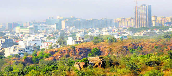
The ‘Gair Mumkin Pahar’
Sushil Manav in Chandigarh
It has taken thousands of years for the Aravallis to become what they are today. The mountain range is spread across 692 km, starting from Delhi and passing through southern Haryana and of Rajasthan. It was in around 1560 AD that Akbar's famed minister Todar Mal introduced a land survey and settlement system: the Aravalis were called 'Gair Mumkin Pahar' (uncultivable hill).
The 'Gair Mumkin Pahar' can be described as an uncultivable wasteland which cannot be held, occupied or used for agriculture, horticulture, animal husbandry and poultry farming, among others. In Haryana, the Aravallis pass through Gurugram and Faridabad as also through Mahendragarh and Rewari, with most of the land being thick in vegetation, a rare in a state that otherwise has the second lowest forest cover in the country.
Almost 450 years later, the Haryana government is confused over what Aravallis range is. It has decided to take up a ground verification exercise so that the revenue records and satellite maps of 2014 may identify natural conservation zones (NCZ) in the national capital region (NCR).
During a recent meeting of the National Capital Region Planning Board, the state government departed from a stand taken at two different occasions, saying it wants to know the “truth”.
“The confusion about the Aravallis was sorted out in the meeting. Areas that fall under the NCZ as per assessed comparison will be conserved,” said Haryana CM Manohar Lal Khattar. Environmentalists, however, feel that this is an attempt to benefit builders, many of whom have managed to get licences to develop projects in the past. Only recently, the Khattar government had allowed felling of trees in the Aravallis to a big builder leading to resentment among environmentalists as well as forest officers. The National Green Tribunal (NGT) recently summoned revenue records from the government in that case.
The state government's confusion can gauged from the fact that on June 15, it wrote to the NCR Planning Board saying that there are no Aravalli hills in Haryana outside Gurgaon district for inclusion in the conservation zones. This amounted to excluding over 17,000 acres in Faridabad from the belt, as also in other districts.
The Regional Plan 2021 for the Delhi NCR region puts environmentally sensitive areas in a protective Natural Conservation Zone (NCZ) and also includes a map of the ‘proposed land use’ that shows the entire Aravalli areas of the NCR, as depicted in satellite imagery, as NCZ. All Aravalli areas, including forests, water bodies, rivers, groundwater recharge areas are zoned as NCZ in the regional plan. The importance of the NCZ is that it is earmarked for conservation, rather than real estate.
Accordingly, construction is allowed only for 0.5 per cent of the area, and that too for purposes that are pursuant to regional recreational activities such as parks and sanctuaries. This precludes construction of commercial complexes, residential buildings and other real estate work.
But in the recent NCRPB meeting, the state government abandoned both these stands, the one taken in its June 15 letter and the other shown in the Regional Plan. If the "ground-truthing" exercise excludes certain areas from the Aravallis, the builders will surely be benefited as there would be no restrictions on them in that case.
Environmental experts maintain that even if the state government wants to go for ground verification, it should refer to 2005 satellite maps since major construction activities in the Aravallis have happened after that year. "Otherwise, the exercise will benefit builders only while the people living in Gurugram and Faridabad will be the losers," says Chetan Agarwal, an environmental analyst from Gurugram. .
Sources say that the Haryana government had not published its sub-regional Plan 2021 till 2014. In the interim, it published two master plans for Gurugram that ignored the NCZ zoning category completely — the Gurgaon Manesar Urban Complex (GMUC) Final Development Plan 2021, and GMUC 2025 plan.
Finally after much objections, the GMUC 2031 plan designed to show the Aravallis as NCZ in the map, slipped in an exception clause in the text — that the Aravallis are a part of the NCZ, except in the some urban area.
Sources say from 2005 to 2014, the state government issued numerous licences in areas already earmarked as NCZ in the RP 2021, such as Aravalli areas, or areas which met the definitional criteria for NCZ such as water bodies, but were to be identified. Permissions issued included one for 350 acres of largely Aravalli areas in Wazirabad hills in Gurgaon, which included the best forest cover of the city. Another licence was issued for residential construction work on 52 acres of the hill-range in SaraiKhwaja area of Faridabad in May 2013.
Several licences, were given in the Aravalli hills of Mangar, Gwalpahari and other villages in the periphery of Delhi.
In June 2014, the state government notified its Sub Regional Plan (SRP) 2021 and the Aravallis were put in the NCZ category in the land-use map. However, an ‘exception’ clause was also inserted in the text of the plan, not in the Regional Land Use chapter which dealt with the zoning, but in the Environment Chapter.
“The Aravallis are our valuable ecological cover and should be protected for that reason,” says environmentalist Agarwal. But Haryana Forest Minister Rao Narbir Singh says the land in the Aravallis belongs to private persons who have invested money on it. “Though the issue pertains to the Town and County Department, our government is of the view that let the ground situation be verified first so that people who have invested money do not have to suffer losses,” the minister said.


